Boar's Tusk
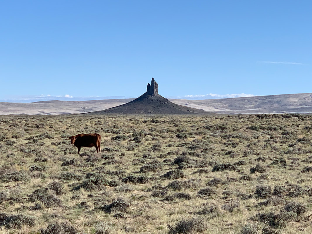
Picture by Mark Fisher
Picture by Mark Fisher
Wow Factor (3 out of 5 stars):
Geologist Factor (3 out of 5 stars):
Geology of Leucite Hills
The Leucite Hills are on the north flank of the Rock Springs Uplift, 30 miles northeast of Rock Springs. They are a series of mesas and buttes whose tops, rising hundreds of feet above the floor of the Red Desert, mark a former level of the basin floor. They were named by the 40th Parallel Survey in 1871 for the mineral Leucite contained in the rocks. This was the first discovered occurrence of leucite-bearing rocks in North America. The hills are the eroded remnants of a late Pliocene- to early Pleistocene-age (3.1-0.9 million years ago) volcanic field. Today geologists call these rare ultra-potassic, mafic igneous rocks lamproites. The name lamproite originates from the Greek word “lampro” meaning "glistening,” a reference to the mica crystals (phlogopite) that characterize this type of volcanic rock.
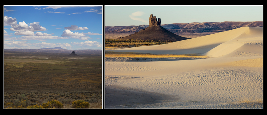
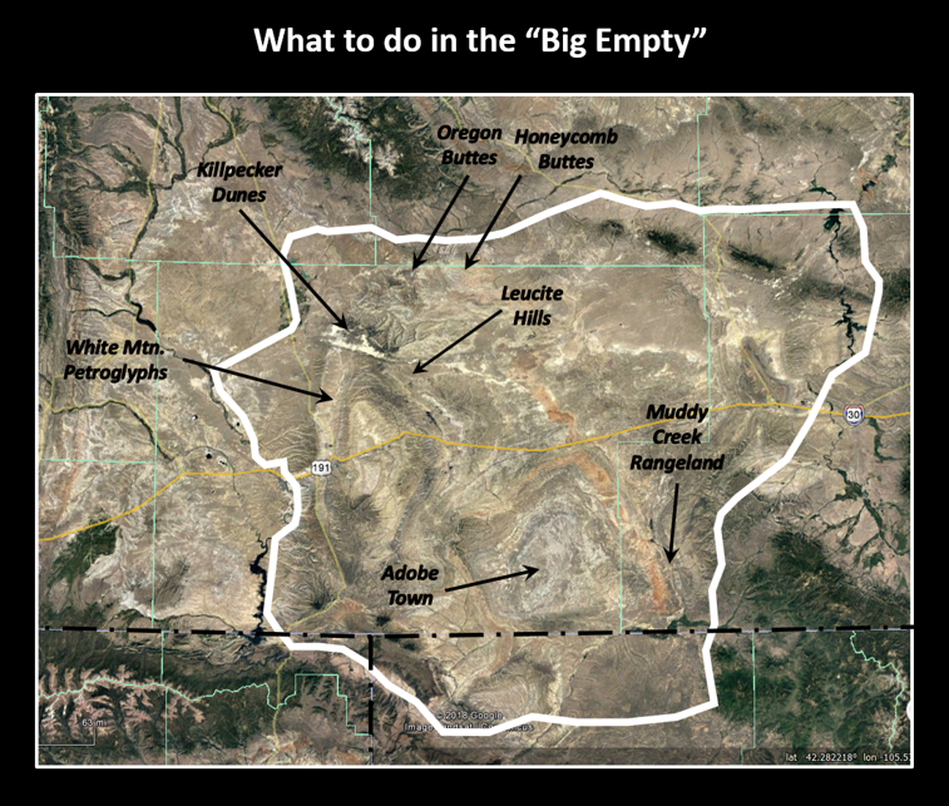
Left: Southeast view of the Boars Tusk (right center) to the mesas of North, Middle and South Table Mountains (distant horizon). These features are part of the Leucite Hills volcanic field that developed along the northern flanks of the Rock Springs Uplift. This is an area that has been called the Big Empty. The elevated ground in front of the Table Mountains is dipping Cretaceous rocks on the north-plunging nose of the Rock Springs anticline.
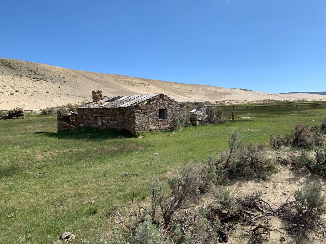
Right: West view of the Boars Tusk with encroaching Killpecker dunes. This is one of the largest active sand dune fields in North America (109,000 acres). They are also noted for their “singing” ability. The volcanic neck contains sedimentary xenoliths of Wasatch and Green River Formations, granitic xenoliths from continental crust, and brecciated lamproite from the mantle. Ridgeline in the distance exposes paleolake beds of Eocene Lake Gosiute (Tertiary Green River Formation) on White Mountain.
Image: Left: Ogle, Ed, 2013, The Boars Tooth, https://en.m.wikipedia.org/wiki/Boars_Tusk#/media/File%3AThe_Boar's_Tusk_(30800758975).jpg;
Right: Wick, Bob, 2016, BLM Image, http://mypubliclands.tumblr.com/post/132968255757/boars-tusk-is-the-most-prominent-feature-within-a
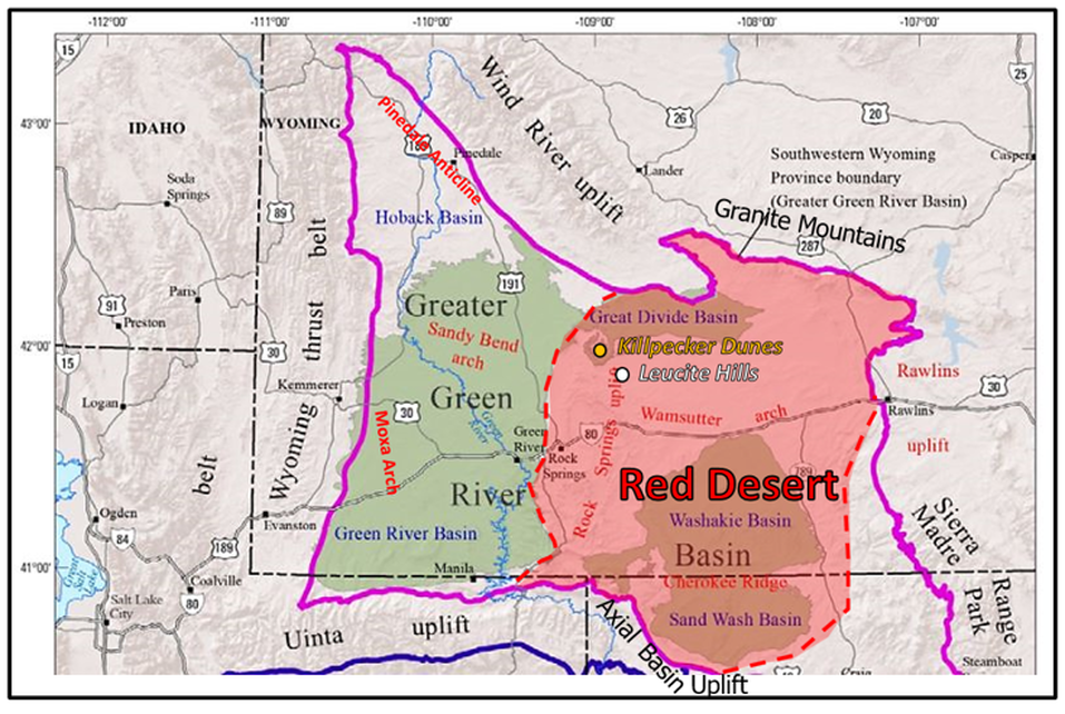
Greater Green River Basin sub basin terminology. The Red Desert Basin includes the Great Divide, Washakie, Sand Wash Basins and the Rock Springs Uplift area.
Image: After U.S. Geological Survey
Image: After U.S. Geological Survey
The volcanic field lies in the north central part of the Greater Green River Basin. This large province in southwestern Wyoming is a Late Cretaceous to Eocene-age area of subsidence surrounded on three sides by structural arches created during the Laramide mountain building event (80 to 55 million years before present). The Wind River Range and Granite Mountains are on the north; the Rawlins Uplift and Sierra Madre on the east; and the Axial Basin uplift of Colorado, and the Uinta Mountains of Utah mark the southern boundary. The western margin is defined by the thrust belt structures created by the Sevier Orogeny (140 to 50 million years before present).
This vast basin consists of five positive areas and five sub basins as shown on the map above. The Rock Springs Uplift and the eastern portion of the Greater Green River Basin have been called the Red Desert since the government surveys of the 1870s. The named came from the soil color of the basin floor and the hues of the eroding Tertiary rocks.
This vast basin consists of five positive areas and five sub basins as shown on the map above. The Rock Springs Uplift and the eastern portion of the Greater Green River Basin have been called the Red Desert since the government surveys of the 1870s. The named came from the soil color of the basin floor and the hues of the eroding Tertiary rocks.
North aerial view of the Leucite Hills region. GDB: Great Divide Basin, GRB: Green River Basin, RDB: Red Desert Basin (red dashed line), WRD: Wind River Basin. Trails shown by white dotted line. Numbered locations: 1) Steamboat Mountain, 2) North Table Mountain, 3) Middle Table Mountain, 4) South Table Mountain, 5) Endlich Hill, 6,7,8) Iddings, Weed, Hallock, 9) Hague Hill, 10) Deer Butte, 11) Hatcher Mesa, 12) Spring Butte, 13) Black Rock, 14) Cabin Butte, 15) Emmons Mesa, 16) Zirkel Mesa. 17) Boars Tusk, 18) Matthews Hill, 19) Twin Rocks (aka Badgers Teeth), 20) Pilot Butte.
Image: Google Earth
Image: Google Earth
Historically, the Red Desert was considered an extension of the Great American Desert. This so called “land in between” was a place one needed to endure and cross as quickly as possible. The Oregon, California and Mormon trails skirted the northern and western edge of the Red Desert Basin. The Overland Stage trail, the Pony Express and the Transcontinental railroad followed Bitter Creek through the central part of the basin and the Rock Springs Uplift.
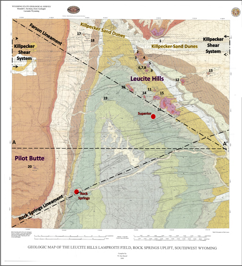
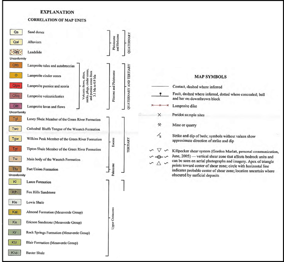
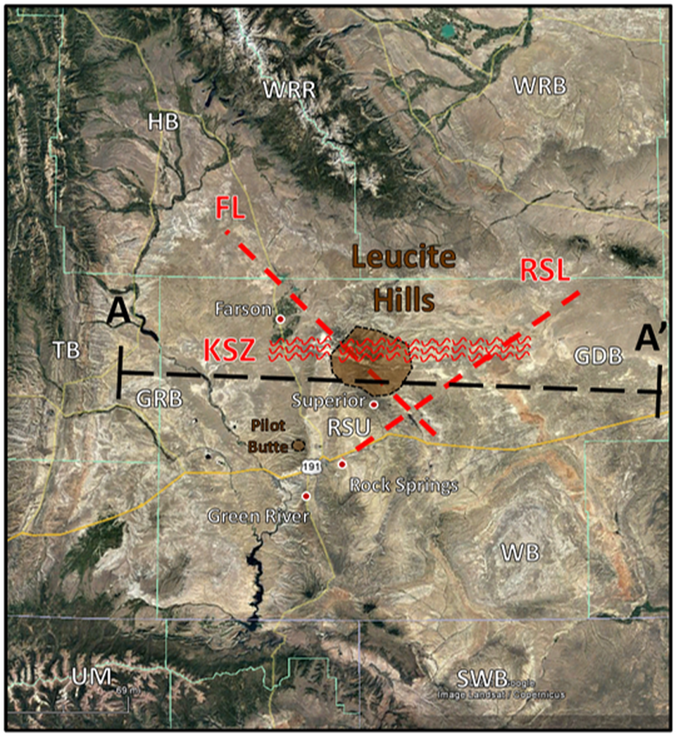
The major geologic structure within the basin is the Rock Springs Uplift. The uplift is a Laramide-age asymmetric anticline with a buried thrust zone on the west flank. The elevation of basement granite on the thrusts has folded Cretaceous rocks at the surface of the structure. Two regional linear structural elements (lineaments) intersect on the northeastern flank of the uplift. These features are thought to be the result of Proterozoic tectonic events on the Wyoming craton. Many of the Leucite volcanic field features align with the northwest trending Farson Lineament. Pilot Butte, the southwestern volcanic outlier, is located north of the northeast trending Rock Springs Lineament. A third feature, called the Killpecker shear system, is an east-west trending structure is shown on the Leucite Hills geologic map (Hausel, 2003). This shear zone crosses the northern portion of the volcanic field and may conceal hidden olivine lamproites (Erlich and Hausel, 2002). The intersection of these crustal structures created fracture zone pathways that the deep sourced lamproites could intrude.
The major geologic structure within the basin is the Rock Springs Uplift. The uplift is a Laramide-age asymmetric anticline with a buried thrust zone on the west flank. The elevation of basement granite on the thrusts has folded Cretaceous rocks at the surface of the structure. Two regional linear structural elements (lineaments) intersect on the northeastern flank of the uplift. These features are thought to be the result of Proterozoic tectonic events on the Wyoming craton. Many of the Leucite volcanic field features align with the northwest trending Farson Lineament. Pilot Butte, the southwestern volcanic outlier, is located north of the northeast trending Rock Springs Lineament. A third feature, called the Killpecker shear system, is an east-west trending structure is shown on the Leucite Hills geologic map (Hausel, 2003). This shear zone crosses the northern portion of the volcanic field and may conceal hidden olivine lamproites (Erlich and Hausel, 2002). The intersection of these crustal structures created fracture zone pathways that the deep sourced lamproites could intrude.
Geologic Map of the Leucite Hills. Numbered locations same as on aerial view shown above. Structural lineaments shown by black dash-dot line. Reported east-west trending Killpecker shear zone shown by wavy lines across the Killpecker Dunes. Structural cross section A-A’ shown on image below.
Image: After Hausel, W.D., 2006, Geology and geochemistry of the Leucite Hills volcanic field: Wyoming State Geological Survey Report of Investigations 56, Plate 1; http://sales.wsgs.wyo.gov/geology-and-geochemistry-of-the-leucite-hills-volcanic-field-2006/
Image: After Hausel, W.D., 2006, Geology and geochemistry of the Leucite Hills volcanic field: Wyoming State Geological Survey Report of Investigations 56, Plate 1; http://sales.wsgs.wyo.gov/geology-and-geochemistry-of-the-leucite-hills-volcanic-field-2006/
Structural cross section of the Rock Springs Uplift with lamproite intrusion (red pipe) and fracture system (wavy lines) from intersecting structural lineaments.
Image: After School of Energy Resources, University of Wyoming; http://images.slideplayer.com/32/9881441/slides/slide_3.jpg
Image: After School of Energy Resources, University of Wyoming; http://images.slideplayer.com/32/9881441/slides/slide_3.jpg
Regional lineaments in Rock Springs Uplift-Leucite Hills area. The Lamproite volcanic system is aligned with the Farson Lineament. Pilot Butte is located to the north of the Rock Springs Lineament. Lineaments: FL: Farson lineament (N40oW), RSUL: Rock Springs lineament (N65oE), FSZ: Killpecker shear zone (N90oE); Basins: GDB: Great Divide Basin, GRB: Green River Basin, HB: Hoback Basin, SWB: Sand Wash Basin, WRB: Wind River Basin; Uplifts: RSU: Rock Springs Uplift, TB: Thrust Belt, UM: Uinta Mountains, WRR: Wind River Range.
Image: Google Earth; Data: After Blackstone, D.L., Jr., 1972, Analysis of ERTS-1 Imagery and its Application to Evaluation of Wyoming’s Natural Resources: Goddard Space Flight Center, NASA; https://ntrs.nasa.gov/archive/nasa/casi.ntrs.nasa.gov/19730005598.pdf
Image: Google Earth; Data: After Blackstone, D.L., Jr., 1972, Analysis of ERTS-1 Imagery and its Application to Evaluation of Wyoming’s Natural Resources: Goddard Space Flight Center, NASA; https://ntrs.nasa.gov/archive/nasa/casi.ntrs.nasa.gov/19730005598.pdf
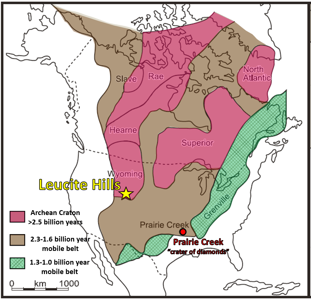
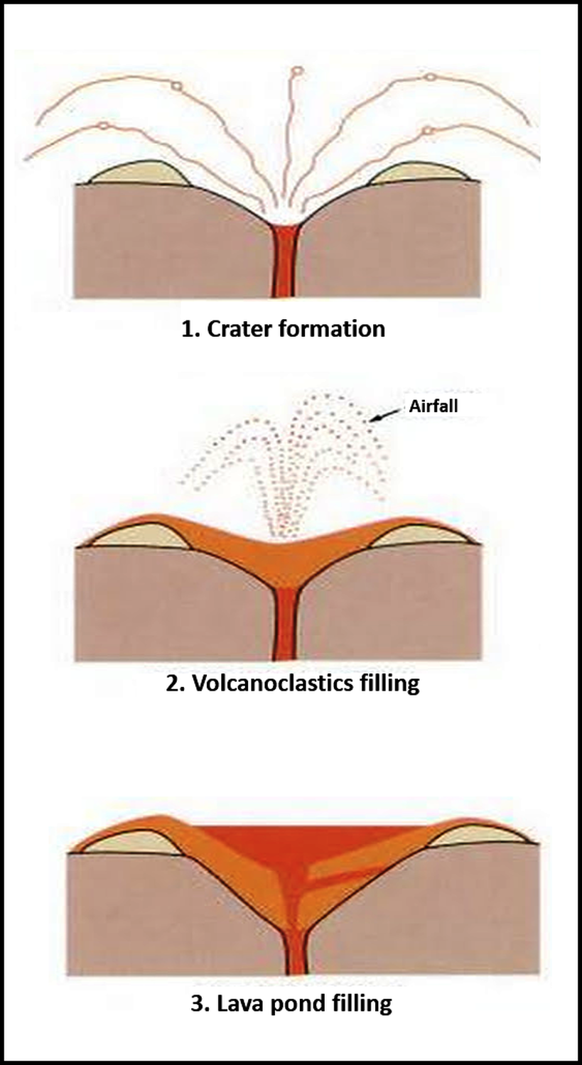
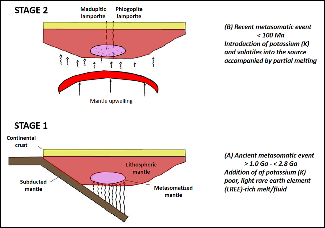
Most of the earth’s lamproites form in a two-stage process and occur at post-tectonic margins of Archean cratons. They are found within the craton edge or in the adjacent Proterozoic terrane. In the first stage alkaline magma is generated deep beneath continental crust by fluid-induced chemical alteration (metasomatism) of mantle rock. The metasomatism may be related to the subduction during the assembly of cratons. Second stage lamproite magmas form from partial melting of previously metasomatized mantle at depth of 90 miles or more. The magma ascends rapidly, exploiting deep crustal fractures (Farson Lineament?). In cross section, the volcano tends to resemble a “champagne or martini glass,” with a broad flaring vent on a narrow tube. The widened vent is due to gases and fluids within the magma eroding the wall rock much more than in kimberlites. It also suggests that lamproite volcanoes erupt with slightly less speed and intensity than their kimberlite cousin.
The North American continent showing the location of the Archean Wyoming Craton, Leucite Hills, WY and the Prairie Creek Lamproite, AR (from Hausel, 1998).
Image: After Ishikawa, A. and Kawai, K., 2015, Ultrapotassic Magma from the Deep Mantle, Leucite Hills Lamproite, Wyoming USA: Journal of Geography (Chigaku Zasshi), Fig. 2A, p. 517; https://www.jstage.jst.go.jp/article/jgeography/124/3/124_124.515/_article/
Image: After Ishikawa, A. and Kawai, K., 2015, Ultrapotassic Magma from the Deep Mantle, Leucite Hills Lamproite, Wyoming USA: Journal of Geography (Chigaku Zasshi), Fig. 2A, p. 517; https://www.jstage.jst.go.jp/article/jgeography/124/3/124_124.515/_article/
The genesis of a lamproite pipe: 1. flared crater formation by erosion of country rock by magma fluids and gases, with development of tuff ring, 2. crater partially filled with volcanoclastics, 3. Extrusion of lava pond to fill crater.
Image: After Earth Science Australia website after original sketch by Barbara Scott-Smith;
http://earthsci.org/mineral/mindep/diamond/diamond.html#Where
Image: After Earth Science Australia website after original sketch by Barbara Scott-Smith;
http://earthsci.org/mineral/mindep/diamond/diamond.html#Where
Modern classification of lamproites is based on the rock’s dominant mineralogy. Five groups are recognized in the Leucite Hills: 1. diopside–leucite-phlogopite lamproites (Wyomingite: Zirkel Mesa); 2. diopside–sanidine–phlogopite lamproites (Orendite: North Table Mountain, South Table Mountain, Zirkel Mesa); 3. olivine-bearing diopside-sanidine-phlogopite lamproite (Olivine Orendite: Black Rock), 4. madupitic lamproites (Madupite: Pilot Butte); 5. transitional madupitic lamproites (Transitional Madupite: Middle Table Mountain, Badgers Teeth), The first three groups account for 99% of the rock volume and are chemically related, originating from the same mantle source. The latter two accounts for only 1% of the rock volume. They are also chemically related but distinct from the previous. The difference may be the result of crustal assimilation, variation in depth of partial melting, and/or source mineralogy.
Zirkel Mesa the largest lamproite exposure in the Leucite Hills and rock samples.
Images: Top Left: mesa and Wyomingite images: St. John, J., 2014, https://www.flickr.com/photos/jsjgeology/14636889580, Top Right: http://www.umanitoba.ca/science/geological_sciences/faculty/arc/lamproite.html Bottom Left & Center: St. John, J., 2014, https://www.flickr.com/photos/jsjgeology/14636889580; Bottom Right: scoria: Hausel, W.D., 2013, http://leucitehills.blogspot.com/2013/09/photo-gallery-of-leucite-hills-wyoming.html;
Images: Top Left: mesa and Wyomingite images: St. John, J., 2014, https://www.flickr.com/photos/jsjgeology/14636889580, Top Right: http://www.umanitoba.ca/science/geological_sciences/faculty/arc/lamproite.html Bottom Left & Center: St. John, J., 2014, https://www.flickr.com/photos/jsjgeology/14636889580; Bottom Right: scoria: Hausel, W.D., 2013, http://leucitehills.blogspot.com/2013/09/photo-gallery-of-leucite-hills-wyoming.html;
Rock samples from Black Rock, the easternmost exposure of the Leucite Hill volcanic field
Images: Top Left:: St. John, J., 2014, https://www.flickr.com/photos/jsjgeology/14636889580, Top Right: https://www.mindat.org/photo-698954.html, Bottom all hand samples: St. John, J., 2014, https://www.flickr.com/photos/jsjgeology/14636889580.
Images: Top Left:: St. John, J., 2014, https://www.flickr.com/photos/jsjgeology/14636889580, Top Right: https://www.mindat.org/photo-698954.html, Bottom all hand samples: St. John, J., 2014, https://www.flickr.com/photos/jsjgeology/14636889580.
Metasomatic stages of Leucite Hills source evolution. The model is based on the incompatible elements and volatile contents of the two major types of lamproite in the Leucite Hills and melting experiments of primary lamproites. Ma: million years; ago, Ga: billion years ago.
Image: After Mirnejad, H. and Bell, K., 2006, Origin and Source Evolution of the Leucite Hills Lamproites: Evidence from Sr–Nd–Pb–O Isotopic Compositions: Journal of Petrology, Vol. 43, No. 12, Fig. 11, p. 2478; https://academic.oup.com/petrology/article/47/12/2463/1564947
Image: After Mirnejad, H. and Bell, K., 2006, Origin and Source Evolution of the Leucite Hills Lamproites: Evidence from Sr–Nd–Pb–O Isotopic Compositions: Journal of Petrology, Vol. 43, No. 12, Fig. 11, p. 2478; https://academic.oup.com/petrology/article/47/12/2463/1564947
Diamonds were discovered in the Prairie Creek diatreme, Arkansas in 1906. The intrusion was emplaced during the Albian Stage of the Cretaceous, 106 million years before present. The diamonds were dated at 3.2 billion years before present. Until the late 1970s, the host rock was thought to be kimberlite. With the discovery of diamonds within the Argyle lamproite pipe of western Australia in 1979, renewed analysis of the Prairie Creek igneous rock showed that the “crater of diamonds” in Arkansas was a lamproite (olivine lamproite and diopside madupitic lamproite). Mining attempts at Prairie Creek proved not to be commercially successful. All the seven known diamondiferous lamproites in the world are found in olivine-bearing lamproite. The Leucite Hills have both olivine- and leucite-bearing lamproites.
The Wyoming State Geological Survey unsuccessfully tested Endlich Hill, South Table Mountain, Wortman dike and Black Rock for diamonds in the early 1990s. To date no diamonds have been found in the Leucite Hills volcanic field but total sample weight has been relatively small (about 500 pounds), and results may be undiagnostic (Hausel et al., 1995, WGA). Based on the geology and geochemical signature of chromite minerals recovered, has led one geologist to predict “Diamonds will be found” in the Leucite Hills lamproites. (Hausel, 2008).
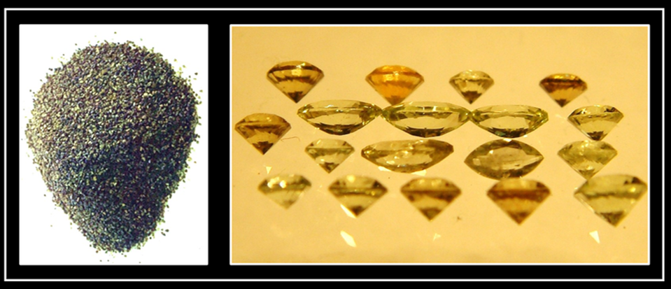
Meanwhile, ants near Black Rock mined 13,000 carats of flawless peridot to decorate their nest hills. It would be good to remember that when exploring for precious stones:
Raw and faceted peridot (gem quality olivine) discovered on ant hills in the Leucite Hills.
Image: Left: http://peridot1.blogspot.com/; Right: http://gemstonehunter.blogspot.com/2008/12/peridot.html
Image: Left: http://peridot1.blogspot.com/; Right: http://gemstonehunter.blogspot.com/2008/12/peridot.html
Leucite Hills Road Log and Publications
The Wyoming Geological Association has published a geologic road log for the Leucite Hills by Hausel, Love and Sutherland in Jones, R.W. and Winter, G.A. (editors), 1995, Resources of Southwestern Wyoming: WGA 1995 Field Conference Road Logs, p. 45-53. There is also a short self-guided road log on the Gemhunter website at http://leucitehills.blogspot.com/2009/02/self-guided-field-trip-to-leucite-hills.html
The Wyoming State Geological Survey has additional information at http://www.wsgs.wyo.gov/
The Wyoming State Geological Survey has additional information at http://www.wsgs.wyo.gov/
- Hausel, W.D., 2006, Geology and geochemistry of the Leucite Hills volcanic field: Wyoming State Geological Survey Report of Investigations 56, 71 p.
- Ogden, Palmer, 1978, Sketch maps of the Leucite Hills, Wyoming: Geological Survey of Wyoming [Wyoming State Geological Survey] Mineral Report 78-1, 2 sheets, scale 1:24,000.
- Osterwald, F.W., 1947, Occurrence of pumice in the southern part of the Leucite Hills, Sweetwater County, Wyoming: Geological Survey of Wyoming [Wyoming State Geological Survey] Mineral Report 47-7, 3 p.
- Hausel, W.D., 1998, Field reconnaissance of the Leucite Hills peridot (olivine) occurrence, Rock Springs uplift, Wyoming: Wyoming State Geological Survey Mineral Report 98-2, 5 p.
- Root, F.K., 1972, Pumice and scoria prospects in the Leucite Hills, sections 4, 10, 12, 14, and 24, T. 21 N., R. 102 W., Sweetwater County, Wyoming: Geological Survey of Wyoming [Wyoming State Geological Survey] Mineral Report 72-1, 5 p.
Things To Do:
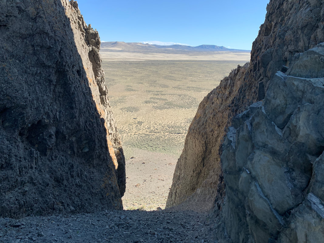
Northeast view from notch in Boar's Tusk with Killpecker Sand Dunes in distance
Image by Mark Fisher
Image by Mark Fisher
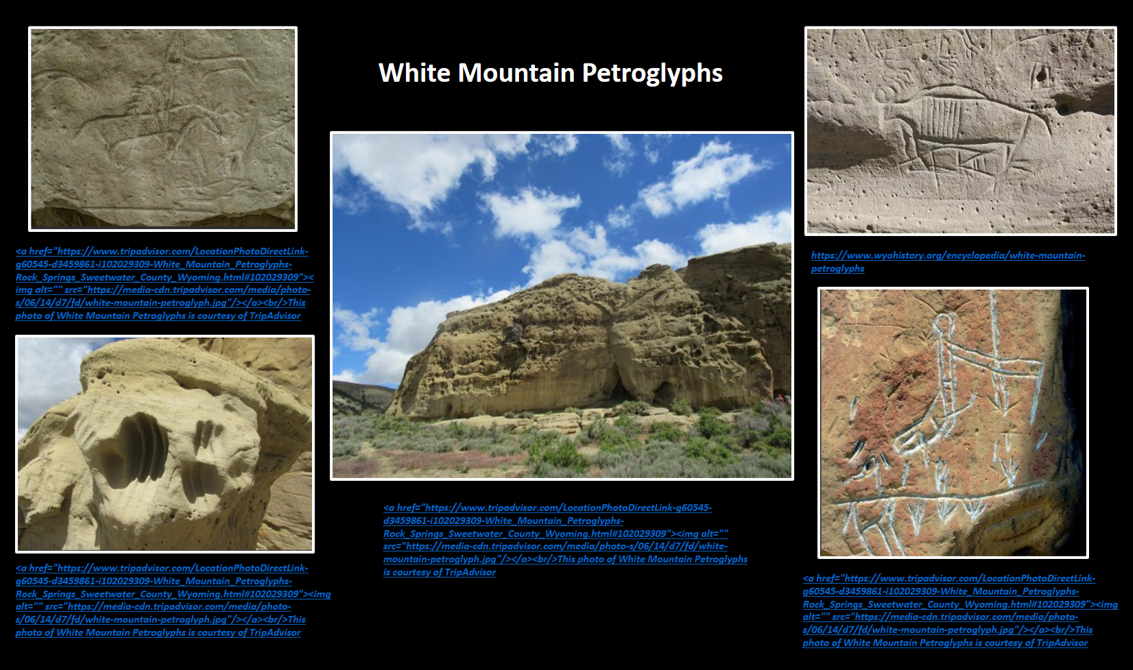
If you have a high clearance 4WD vehicle, our recommendation is to visit Boar’s Tusk, Killpecker Sand Dunes and White Mountain Petroglyphs. All three destinations are within ten miles of each other and depending on how much time you spend exploring, it could be a half day or a whole day outing. You should time your visit to miss the heat in the summer, snow drifts in the winter and mud after the rains or snowmelt. The BLM Rock Springs surface status map would be helpful for navigating. It is isolated Wyoming with minimal to no traffic and miles of gravel & dirt roads, some with mud and sand. The worst conditions we encountered were the last four miles of sandy two-track to Boar’s Tusk.
Directions to White Mountain Petroglyphs, Boar's Tusk & Killpecker Sand Dunes
Directions from Rock Springs to White Mountain Petroglyphs, Boar’s Tusk, and Killpecker Sand Dunes: Zero the trip odometer at the intersection of US 191 and I-80 in Rock Springs. Travel north on US 191 toward Farson/Pinedale, at 8.8 miles turn right (east) on Sweetwater County Road 17, 10.5 miles road curves to left (north), 11.3 miles drive under power lines, 13.7 miles take left at road fork, 21.3 miles cross under power lines, 22.2 miles road on left (west) is three mile side trip to White Mountain Petroglyphs (good road during 2021), 23.4 miles take right at road fork (left is road to US 191), 23.8 miles take left at road fork (right is Pine Canyon), 24.4 miles turn left on Boar’s Tusk two-track 4WD access road with loose sand, deep ruts, high center and minimal pull-offs or turnarounds, 25.6 miles drive under power lines, 28.0 miles park near base of Boar’s Tusk for hiking, return to main road (Sweetwater County Road 17), 31.6 miles turn left on road 17 to reach Killpecker Sand Dunes, 33.7 miles go straight at road intersection, 35.9 miles take left at road fork on BLM 4115 (right is road 17 toward Tri-Territory Historic Site), 36.5 miles take left at road fork on good gravel road up the hill (right leads to BLM Crookston Ranch Cultural Site), 37.0 miles take right at road fork, 37.3 miles natural gas well on left (Nitchie Gulch 1-17 SE SE Sec 17, T23N-R103W), 37.9 miles arrive at Killpecker Sand Dunes OHV Parking/Camping with vault toilet and picnic tables.

The material on this page is copyrighted
