Buffalo Tongue Slide on US 14
Photo by Mark Fisher
Photo by Mark Fisher
Wow Factor (4 out of 5 stars):

Geologist Factor (4 out of 5 stars):

Attraction:
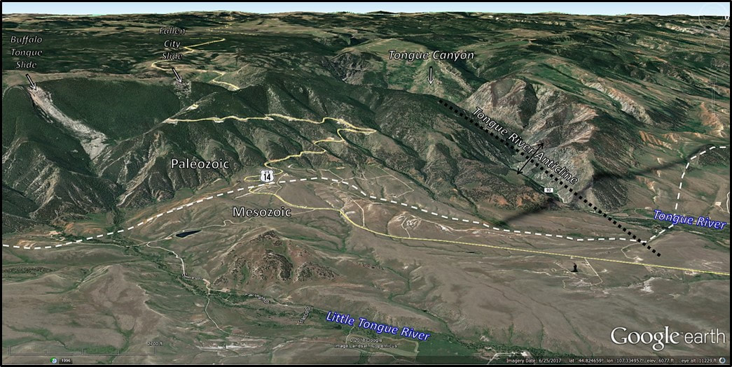
U.S. Highway 14 from Burgess Junction to Dayton travels from the crest of the range down the east flank of the Bighorn Mountains. Scenic drive, hike to Black Mountain Lookout Tower and Tongue River Canyon, remnants of the tie flume, "leopard rock" collecting and views of Fallen City slide.
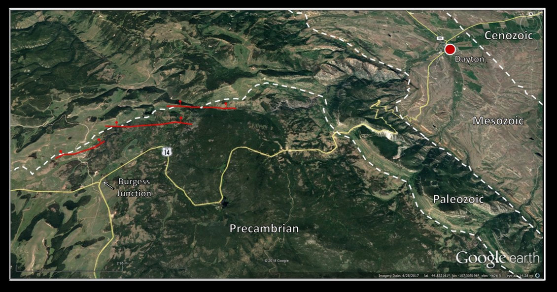
North aerial view of Bighorn Mountain Byways, Part II from Burgess Junction to Dayton, Wyoming. Ages of rock exposed on the surface are labelled and separated by white dashed lines. Red lines are faults with barbells on downthrown side.
Image; Google Earth, Data: Love, J.D., Christiansen, A.C., and Earle, J.L., 1978, Preliminary geologic map of the Sheridan 1 degree x 2 degree quadrangle, northern Wyoming: U.S. Geological Survey, Open-File Report OF-78-456, scale 1:250,000.
Image; Google Earth, Data: Love, J.D., Christiansen, A.C., and Earle, J.L., 1978, Preliminary geologic map of the Sheridan 1 degree x 2 degree quadrangle, northern Wyoming: U.S. Geological Survey, Open-File Report OF-78-456, scale 1:250,000.
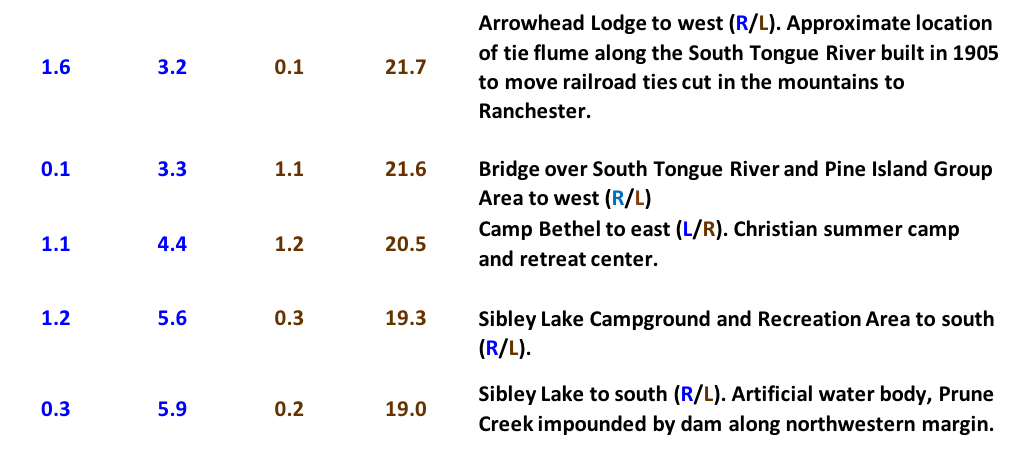
Road Log Bighorn Mountain Byways Part II
This road log is a sequel to Bighorn Mountain Byways Part I. It is edited and compiled from the Wyoming Geological Association Guidebook of 1990 and a paper by Koucky and Cygan (1963) in the Wyoming Geological Association 18th Annual Field Conference Guidebook, pages 17-25. Interval and cumulative mileages are reported west to east (blue) and east to west (brown) to allow travel in either direction.


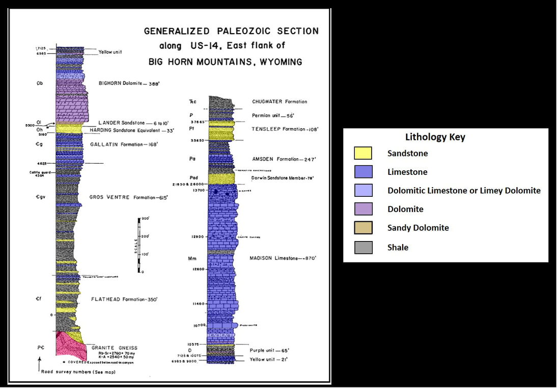
Paleozoic stratigraphic column for US 14 and east flank of Bighorn Mountains.
Image: After Koucky, F.L. and Cygan, N.E., 1963, Paleozoic Rocks Exposed Along U.S. Highway 14 on the East Flank of the Big Horn Mountains, Wyoming: Wyoming Geological Association 18th Annual Field Conference Guidebook, Fig. 1, p. 18.
Image: After Koucky, F.L. and Cygan, N.E., 1963, Paleozoic Rocks Exposed Along U.S. Highway 14 on the East Flank of the Big Horn Mountains, Wyoming: Wyoming Geological Association 18th Annual Field Conference Guidebook, Fig. 1, p. 18.
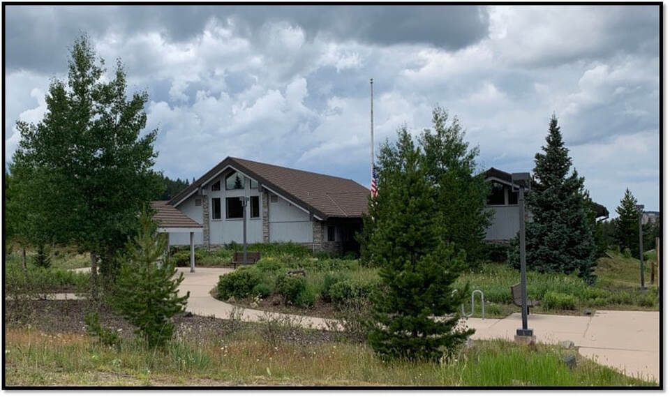
Burgess Junction Visitor’s Center
Image: Mark Fisher
Image: Mark Fisher

Twin Buttes landmark from near Burgess Ranger Station and Work Center
Image: Mark Fisher
Image: Mark Fisher
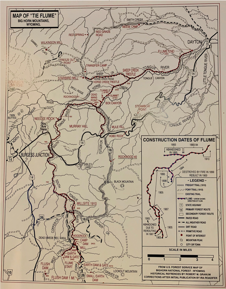
Tie flume map for the Bighorn Mountains. Flumes are marked in red. Fascinating history of tie flumes in the Bighorn Mountains at https://www.wyohistory.org/encyclopedia/tongue-river-tie-flume
Image: Map at Forest Service Burgess Junction Visitor Center
Image: Map at Forest Service Burgess Junction Visitor Center
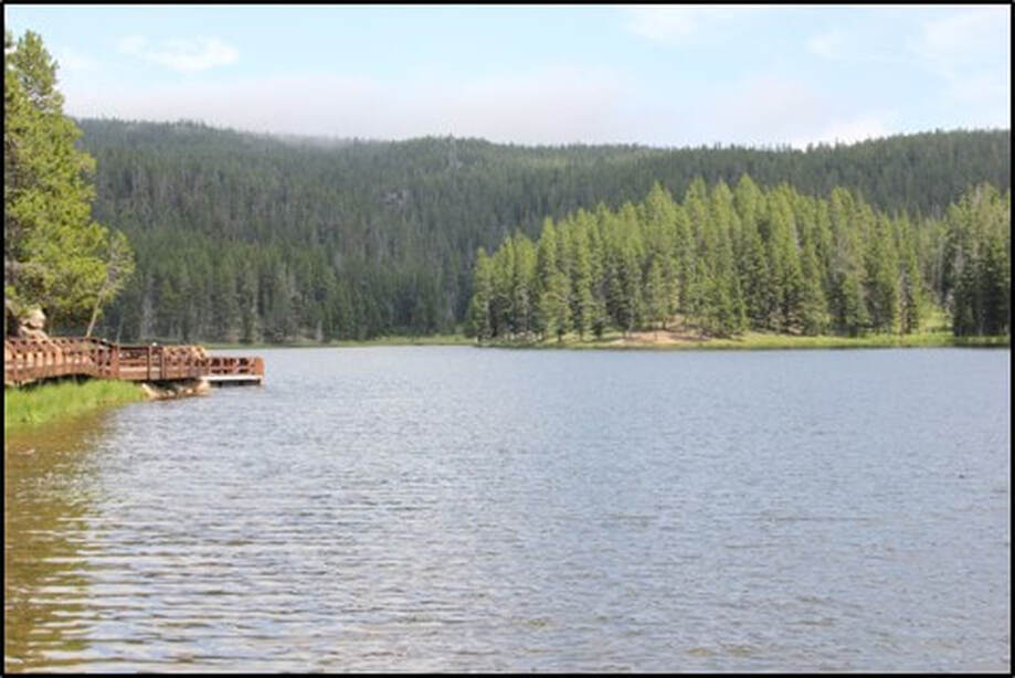
Sibley Lake, Wyoming at 7,900-foot elevation. The area offers fishing, hiking, picnicking and campground opportunities. Sibley Lake is named for Lieutenant Frederick W. Sibley who led a calvary scouting party of 30 men in 1876 to the Tongue River. His party was discovered by a large group of Sioux and Cheyenne warriors. The soldiers escaped into the Big Horn Mountains where they fought, abandoned their horses and evaded Indians over several days. They walked over thirty miles back to their main camp with no casualties. For an engrossing read about the Sibley retreat, see this short story.
Image: USDA Forest Service, 2018, https://www.fs.usda.gov/Internet/FSE_MEDIA/stelprd3809914.jpg.
Image: USDA Forest Service, 2018, https://www.fs.usda.gov/Internet/FSE_MEDIA/stelprd3809914.jpg.


Precambrian basement granite spire. Note the horizontal joints in the outcrop.
Image: Mark Fisher
Image: Mark Fisher
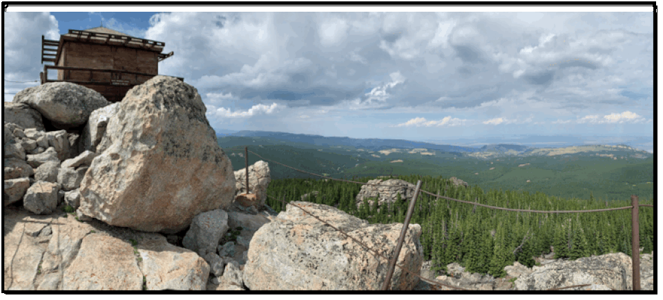
Black Mountain Lookout Tower. Tower was constructed in 1930’s as a fire observation post for the Bighorn National Forest.
Image: Mark Fisher
Image: Mark Fisher
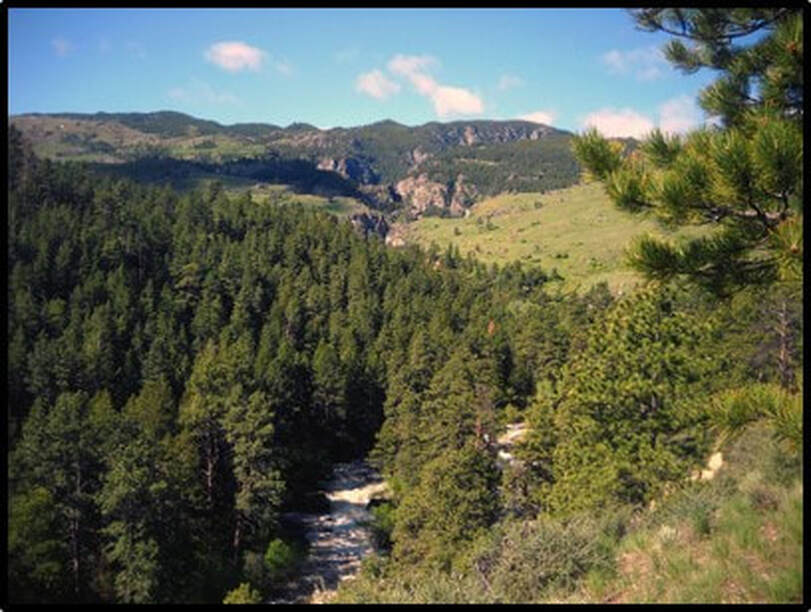
Box Canyon of Tongue River.
Image: Hobart, R., 2017;https://www.hikingproject.com/photo/7029670/the-trail-follows-the-tongue-river-along-a-box-canyon.
Image: Hobart, R., 2017;https://www.hikingproject.com/photo/7029670/the-trail-follows-the-tongue-river-along-a-box-canyon.
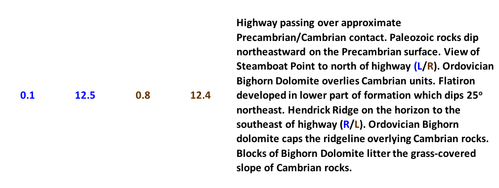
Steamboat Point. Note horizontal and vertical joints in the outcrop. Cgv is Cambrian Gros Ventre Formation, mostly shale; Cg is Cambrian Gallatin Formation, mostly thin limestones; and Ob is Ordovician Bighorn Dolomite
Image: Roth, M., 2012; https://www.mountainproject.com/photo/107616464.
Image: Roth, M., 2012; https://www.mountainproject.com/photo/107616464.


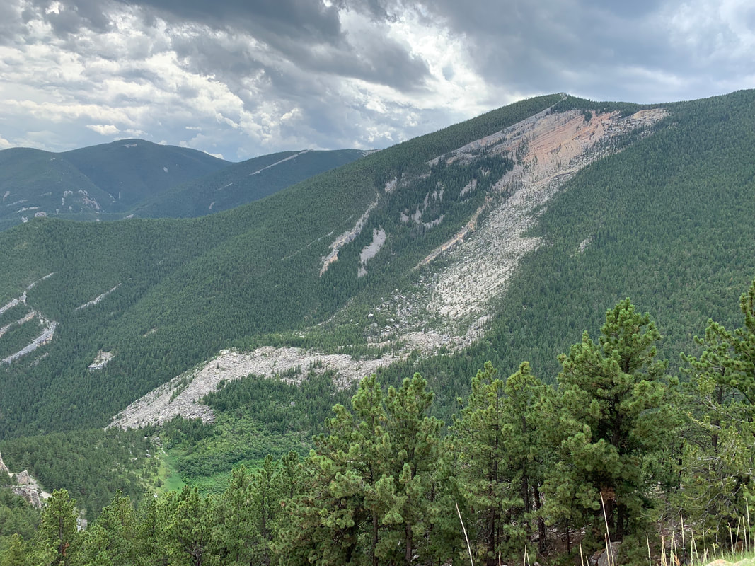
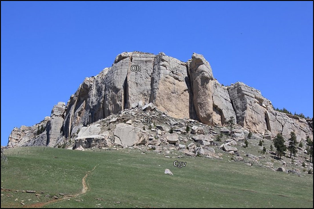
Fallen City block slide. Note scarp wall on right side of image. Blocks are Ordovician Bighorn Dolomite based on mapping by Love, J.D., Christiansen, A.C., and Earle, J.L., 1978, Preliminary geologic map of the Sheridan 1 degree x 2 degree quadrangle, northern Wyoming: U.S. Geological Survey, Open File Report OF-78-456, scale 1:250,000.
Image: Left: https://www.flickr.com/photos/63339942@N00/242153020; Right: U.S. Geological Survey, 2004, Landslide Types and Processes; Fact Sheet 2004-3072; https://pubs.usgs.gov/fs/2004/3072/images/Fig3grouping-2LG.jpg.
Image: Left: https://www.flickr.com/photos/63339942@N00/242153020; Right: U.S. Geological Survey, 2004, Landslide Types and Processes; Fact Sheet 2004-3072; https://pubs.usgs.gov/fs/2004/3072/images/Fig3grouping-2LG.jpg.
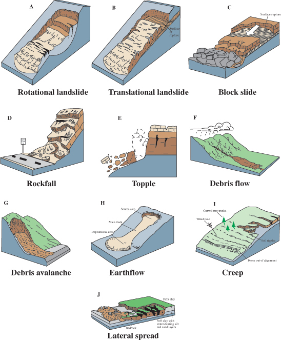
Landslides near U.S. Highway 14, Bighorn Byways.
Image: After Case, J.C., Piwoschuk, K.L., and Murray, W.B., 1984, Preliminary map of landslides on the Sheridan 1° x 2° topographic map: Geological Survey of Wyoming [Wyoming State Geological Survey] Open File Report 84-10, scale 1:250,000.
Image: After Case, J.C., Piwoschuk, K.L., and Murray, W.B., 1984, Preliminary map of landslides on the Sheridan 1° x 2° topographic map: Geological Survey of Wyoming [Wyoming State Geological Survey] Open File Report 84-10, scale 1:250,000.

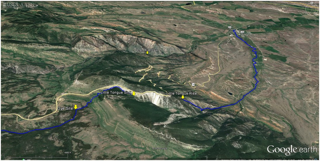
North aerial view of Little Tongue River rise, sink, dye test site and Tongue River Cave.
Image: Google Earth
Image: Google Earth
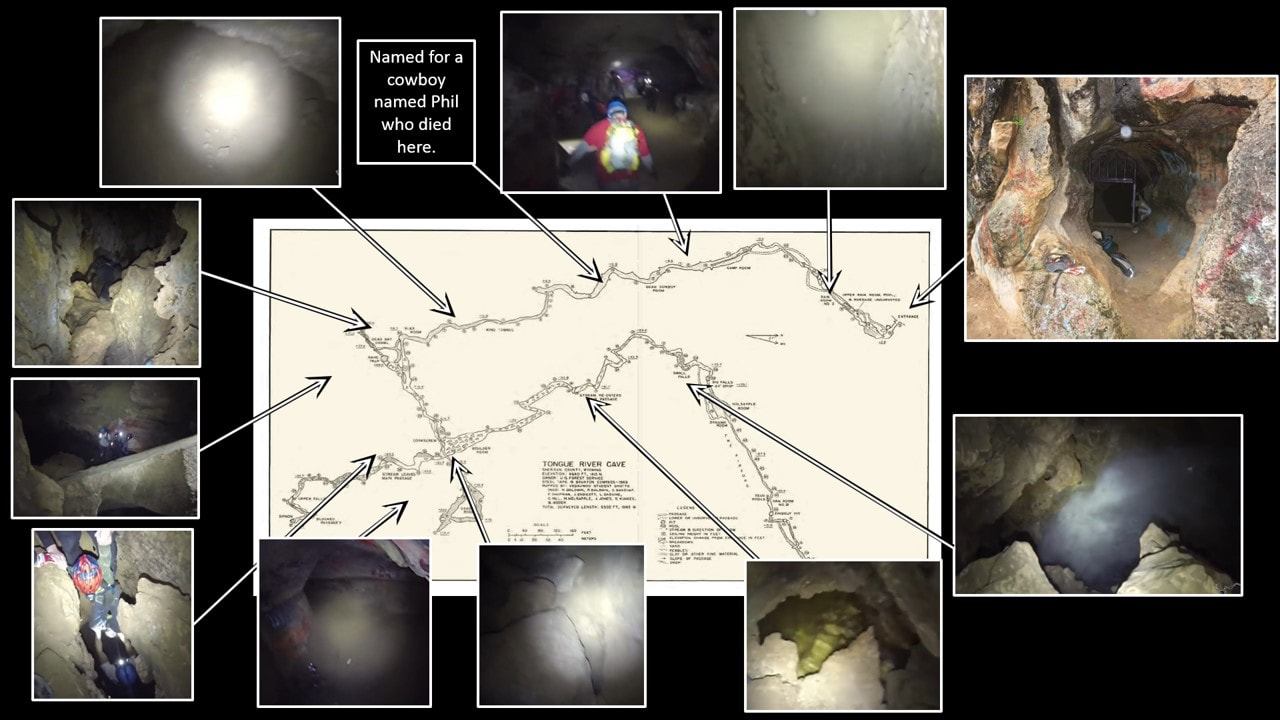
Tongue River Cave. Dye test showed connection with the Little Tongue River sink.
Image: Cave Map: After Hill, C., Sutherland, W., and Tierney, L., 1976, Caves of Wyoming: Geological Survey of Wyoming [Wyoming State Geological Survey] Bulletin 59, Plate 3; http://sales.wsgs.wyo.gov/caves-of-wyoming-1976/;Cave Images: Menendez, T., 2014, Tongue River Cave Video: YouTube; https://www.youtube.com/watch?v=YvuTLiq_wx0.
Image: Cave Map: After Hill, C., Sutherland, W., and Tierney, L., 1976, Caves of Wyoming: Geological Survey of Wyoming [Wyoming State Geological Survey] Bulletin 59, Plate 3; http://sales.wsgs.wyo.gov/caves-of-wyoming-1976/;Cave Images: Menendez, T., 2014, Tongue River Cave Video: YouTube; https://www.youtube.com/watch?v=YvuTLiq_wx0.
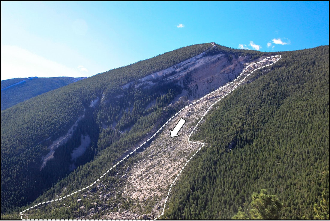
Buffalo Tongue Slide.
Image: USDA Forest Service; https://www.fs.usda.gov/Internet/FSE_MEDIA/stelprd3841484.jpg.
Image: USDA Forest Service; https://www.fs.usda.gov/Internet/FSE_MEDIA/stelprd3841484.jpg.
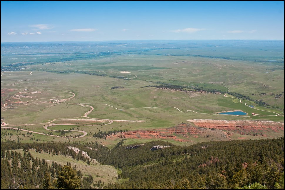
View east onto the Great Plains prairie land.
Image: Hendrix, J. and Hendrix, M., 2014; http://travellogs.us/2014%20Logs/Wyoming/WY-13%20Scenic%20US-14/WY-13a%20Big%20Horn%20Mts%20on%20US-14.htm.
Image: Hendrix, J. and Hendrix, M., 2014; http://travellogs.us/2014%20Logs/Wyoming/WY-13%20Scenic%20US-14/WY-13a%20Big%20Horn%20Mts%20on%20US-14.htm.

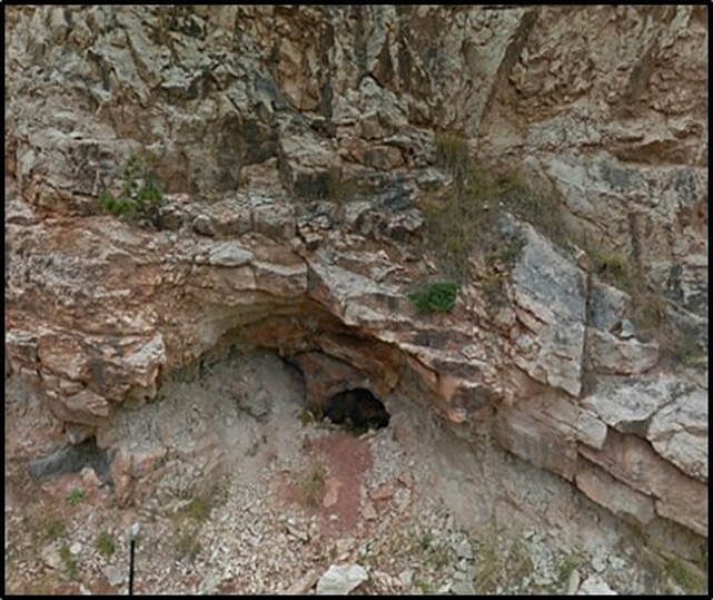
Madison cave on roadside of U.S. Highway 14.
Image: Google Earth Street View.
Image: Google Earth Street View.

Small reverse fault in the Amsden with upthrown side on the right
Image: Mark Fisher
Image: Mark Fisher


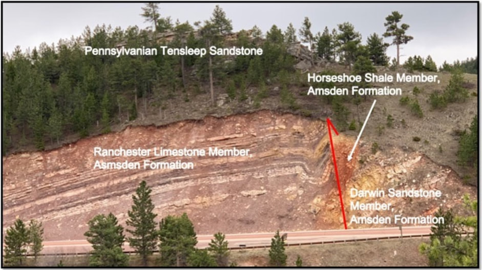
Tensleep-Goose Egg contact.
Image: Mark Fisher
Image: Mark Fisher

Aerial west view of the east flank of the Bighorn Mountains.
Image: Google Earth.
Image: Google Earth.

End Of Road Log
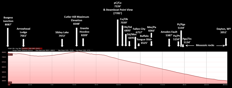
Elevation profile of Bighorn Mountain Byways, Part 2 road log.
Image: Google Earth
Image: Google Earth
Things To Do in Bighorn Mountain Byways Part II
Burgess Junction to Dayton is a pretty area with hikes, rock collecting, fishing, ORV roads, horseback riding trails, hunting and camping. There are a couple of Forest Service campgrounds, one at Sibley Lake and one at Prune Creek. The following are suggested activities: collecting leopard rock on FS 185, hike to Black Mountain Lookout Tower and Tongue River Canyon hike.
Leopard Rock on Forest Service Road 185
Some of the mafic dikes found in the Bighorn Mountains have a spotted or leopard appearance with large white plagioclase crystals in a dark gray fine-grain groundmass. These plagioclase crystals are concentrated in the central portions of the dikes (Stephen Harlan, 2005 Poster GSA Conference pdf). An outcrop of this attractive igneous rock can be found at the end of Forest Service Road 185, a high clearance 4WD rough dirt road that turns off US 14 at 9.9 miles from Burgess Junction or 15 miles from Dayton. FS 185 is on the north side of the US 14 almost opposite the brake check pull off. Directions (see map below): Take FS 185 north, road immediately splits, take right fork on FS 185 (FS 184 goes left and reaches the Tongue River in a couple of miles), drive open ridge with a few stands of trees, 0.6 miles property boundary of State and Forest Service land, 0.8 miles enter trees and pass through gate at high point on ridge, road immediately splits, take left fork on FS 185, 1.4 miles road takes path around large outcrop of Precambrian then heads back up steeply to ridge, 1.7 miles road ends in a circle. Leopard rock outcrop is about 30 feet beyond end of road on a ridge. Dike trends North 58 degrees East. This dike is Precambrian.
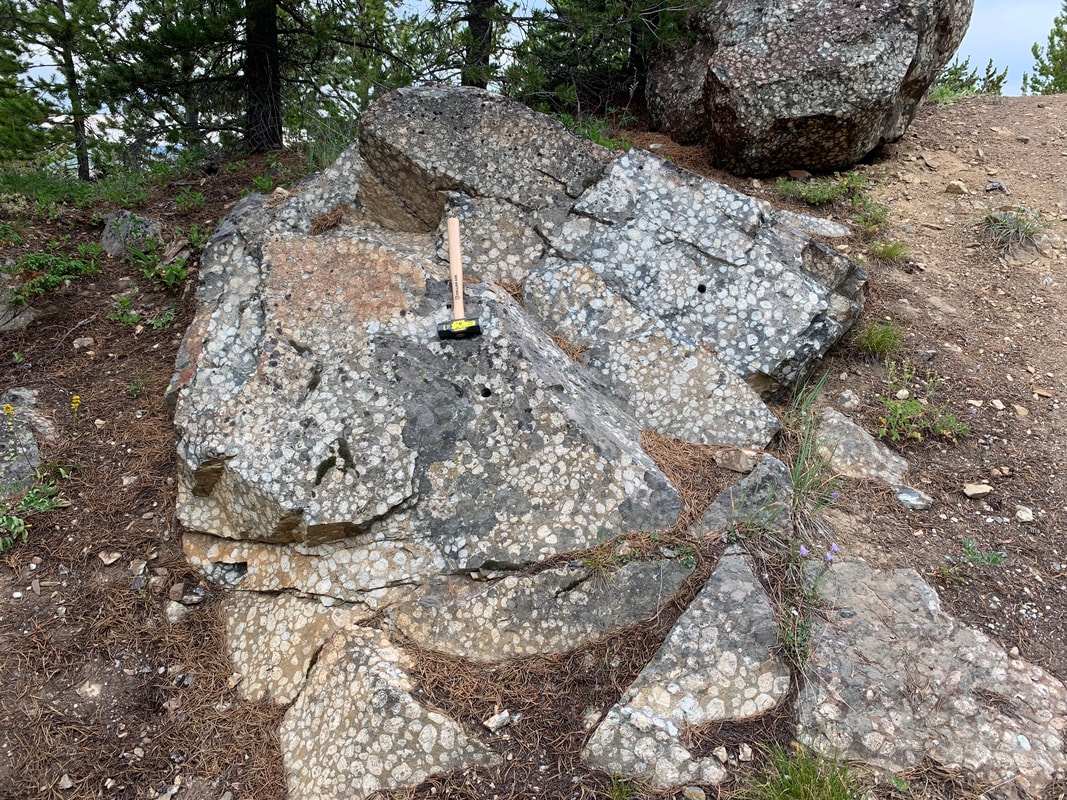
"Leopard Rock" dike at end of Forest Service Road 185
Photo by Mark Fisher
Photo by Mark Fisher
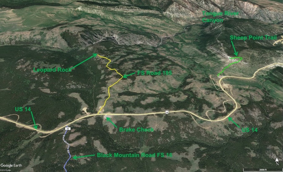
North aerial view of access to Leopard Rock and Sheep Point. Black Mountain Forest Service Road 16 in blue, Forest Service Road 185 in yellow and Sheep Point Trail in green.
Image by Google Earth
Image by Google Earth
Black Mountain Lookout Tower Hike
The hike is through the forest and Precambrian rock the whole way to the Lookout Tower. At the end, you break out of the trees and climb a rock ridge to the Tower with outstanding panoramic views. ATVs and motorcycles are allowed on this trail, although the upper part of the trail seems to rocky and narrow for ATVs. Directions (see map below): Turn south on Black Mountain Forest Service Road 16 which is a good gravel road fine for cars, 3.5 miles turn left on Forest Service Road 222 which is a high clearance, 4WD rutted & rocky dirt road, park immediately if you have a passenger car & walk from here, cross stream and take left fork in road, 3.7 miles second stream crossing, 4.4 miles end of road and Black Mountain Trailhead, hike 1.1 miles one way and 800 vertical feet up to Lookout Tower, return the same way. If you walk FS 222, it adds 0.85 miles each way to the hike. Be aware that the Lookout Tower is on a rock ridge surrounded by cliffs.
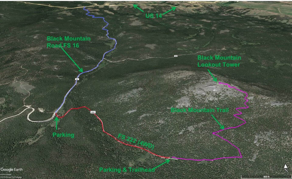
North aerial view of Black Mountain Lookout Tower hike. Forest Service Road 16 in blue, Forest Service Road 222 in red and Black Mountain Trail in purple.
Image by Google Earth
Image by Google Earth
Tongue River Canyon Hike
The trail follows the Tongue River up the canyon for 2.4 miles. At that point, the trail climbs out of the canyon and continues on toward Burgess Junction. At just 0.2 miles from the start of the trail, a bridge across the river leads to a short steep side trip to Tongue River Cave (not the Tongue River Canyon Trail). The cave is closed from October 15 to April 15 to protect the hibernating bats. Registration with the Bighorn National Forest is required to access the cave during the open season. Directions (see map below): From the Mercantile store in downtown Dayton, head toward Ranchester on US 14, 0.2 miles cross bridge over Tongue River and then turn left on Tongue Canyon Road, Sheridan County 92, 0.6 miles end of pavement, 2.6 miles stay left on Tongue Canyon Road at junction with Amsden Road, 3.5 miles campground and public toilet, travel past cliffs of Ordovician Bighorn Dolomite and Mississippian Madison Limestone, 5.1 miles road ends at parking area for Tongue River Canyon Trail, public toilet.
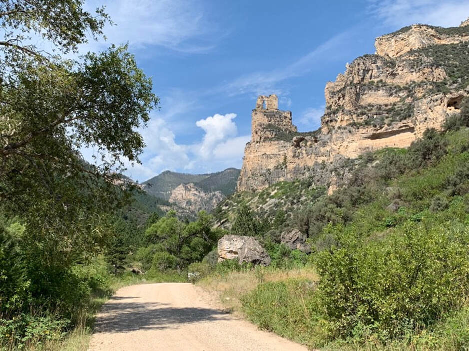
Cliffs of Madison Limestone and Bighorn Dolomite along Tongue Canyon Road
Image by Mark Fisher
Image by Mark Fisher
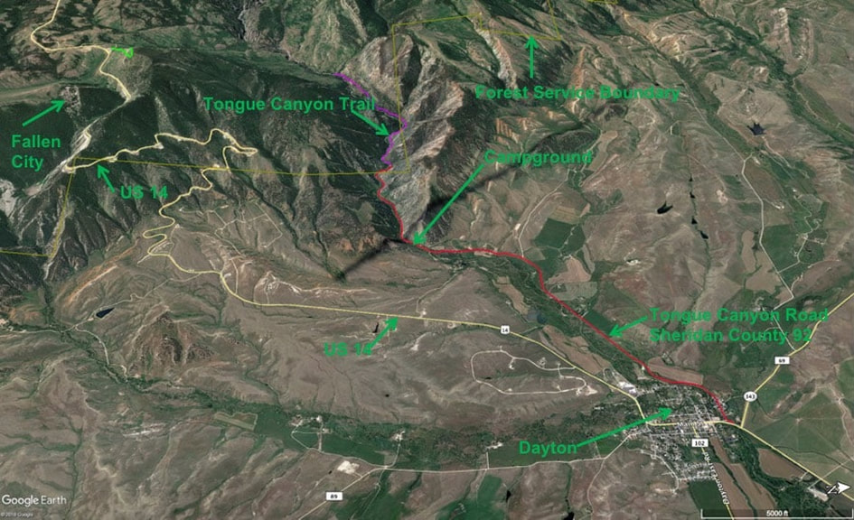
West aerial view of Tongue River Canyon Trail. Tongue Canyon Road in red and Tongue River Canyon Trail in purple.
Image by Google Earth
Image by Google Earth

The material on this page is copyrighted